subscribe to newsletter
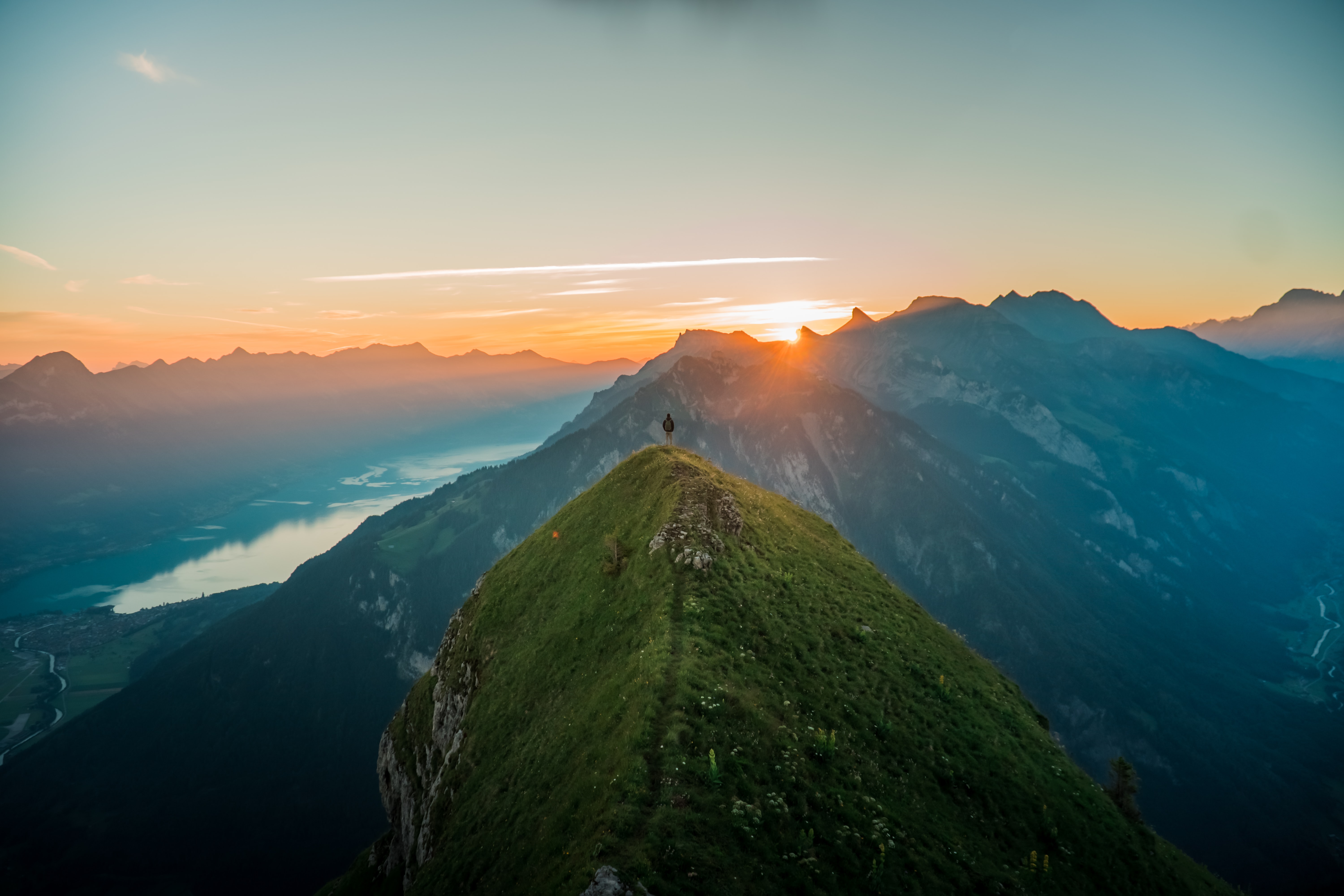
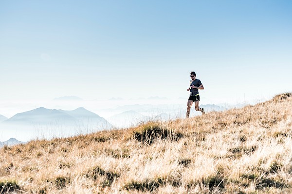
Wanderlust: high above
“Life begins where your comfort zone ends.”
(Unbekannt)
Pascale probably said this to herself as, high above Lake Sarnen, she queasily fought against her fear of heights. Despite her emotional roller-coaster, or maybe precisely because of it, the ridge trail near Wandelen is one of Pascale’s favourite hiking routes.
Sometimes a little effort is needed to discover beautiful new places. Anyone who dares to take the steep climb from the shady end of Melchtal towards the sun and the extensive pastures not visible from the valley floor will be rewarded with an incredible view. The demanding ups and downs along Arnigrat, and the views into the distance, make it very easy to switch off from your everyday life.
Do you fancy some fresh mountain air, sun in your face and fantastic views? Are you sure-footed and physically fit, and don’t suffer from vertigo? Then you might love Pascale’s hike.
Stöckalp – Wandelen – Arnigrat – Flüeli
Route description
Stöckalp – Wandelen (approx. 3 ¼ hours)
Start at Stöckalp (1071 m above sea level), where the path goes steeply uphill until you reach Arnigrat at a point 1921 m above sea level. There you will find that the hiking route category changes significantly (link to article on mountain hiking). The mountain hiking trail, marked in white-red-white, becomes an alpine hiking trail, labelled white-blue-white. This means that, depending on the time of year, the path may be covered in snow. Other features of alpine routes are scree slopes, rocky sections and short rock-climbing passages – with no visible path in places. If you’ve got this far, you maybe know what Pascale meant about a fear of heights. Sure-footedness, the absence of vertigo and physical fitness are required. You are now standing on Arnigrat, a ridge path of unparalleled adventure.
Important: if it is wet, or snowing, if the weather is bad and visibility is poor, do not hike on Arnigrat under any circumstances. The risk of falling is too great, as evidenced by the fatal accident of a young hiker in 2019. This does not mean that you need to be afraid now, but you should hike along Arnigrat with certain amount of respect.
The ridge trail has been described as a “dance on a knife edge”. You then move forwards along a path, barely visible in places, on steep grassy slopes over narrow Arnigrat towards Wandelen. The fun on the narrow ridge is temporarily over at Astelhorn (2084 m above sea level). You continue along a broad grassland ridge towards the summit cross on Wandelen, which at 2104 m is the highest point on this route. Wandelen, Sachseln’s local mountain, has long been considered one of the most beautiful points on this hike. At the summit cross you will find something that is rarely offered: a lovely bench invitingly encircles the cross for you to take a break on. Perfect for recovering from the steep climb and adrenalin kick.
Wandelen – Arnigrat – Höch Dossen (approx. 1 ¼ hours)
After enjoying the glorious view on Wandelen and recharging your batteries, turn right, down into the depths of Mettental. As you descend towards Astelhorn, the path becomes narrower and leads steeply into the notch. The vigorous up-and-down via Astelhorn follows Arnigrat up to a point of 2028 m above sea level. Here you leave the northward markings and follow the ridge down until you reach 1987 m above sea level. A steep narrow path leads further down, around a number of rock structures, and then up again towards Hohmad. From there on, the still very varied route leads through the sunny slopes beneath the edge of the ridge to Höch Dossen (1885 m above sea level).
Höch Dossen – Flüeli-Ranft (approx. 1 ¾ hours)
towards Dössli. A little later, you come to a large meadow, where you will search in vain for route markers, but it’s best to aim directly for the Alpine buildings of Oberbüelen (1378 m above sea level). From there, you slowly follow the now clear markings until you reach Unterbüelen. Then head north, down over Barfeld and Oberhus to Flüeli (727 m above sea level). Congratulations! You have reached your destination!
(Source)
Additional information
Duration
In total, this hike will take somewhat more than 6 hours. For the 1250 metres of ascent, you will need 3 ¼ hours on average, although it is better to allow rather more time so that you can take breaks every now and then. The same is true of the descent of 1600 metres, with an average duration of 3 hours. Such descents are hard on the knees. Therefore you should also calculate extra time for breaks.
Level of difficulty
The difficulty has been categorised as T3+. The most challenging stretches are on Arnigrat. In addition, markers are scarce for long stretches, although you can cope well enough without them, as the trail hugs the ridge, and from Dössli you head directly for the large Alpine buildings. What is more, the ascent from Schöckalp to Stepfen leads through steep woodland and is furnished with some wooden steps and wire ropes etc. to give you support and security over the terrain.
Waypoints
- Wandelen (Arnigrat, 2104 m above sea level)
- Astelhorn (2083 m above sea level)
- Höch Dossen (1886 m above sea level)
Pascale’s tip for fear of heights
The only way to combat a fear of heights is to leave your comfort zone and subsequently to enjoy succeeding at the challenge. But it is very important not to rush anything. It’s better to approach the challenge with small steps. If you don’t manage to get your fear under control, you will experience a vicious circle that will only confirm your fear of heights.
If you reach an exposed place that causes you problems, inform your hiking partners as early as possible. It would not be sensible to set out alone on a hiking route that would push you to the limits of your fear of heights or be too challenging. If you are gripped by fear, it is important to breathe deeply in and out. Set your eyes on a fixed point nearby so the dizziness subsides. Sit down slowly onto the ground or at least kneel down, so you can feel the ground beneath you. This should reduce your fear of falling. Keep on breathing deeply until your pulse is calm. You could also actively tense your muscles for a few seconds, then let them go, to relieve any cramps a little.
When your fear has levelled off, look at the place carefully and determine the point you next want to reach before you have another break. Before marching on, take a few steps forward, to see if you can cope with going any further. If you can’t, it’s better to turn back. If, however, you realise that you can reach the next point, walk slowly on. Focus only on your next step. Before you know it, you will have arrived at the place for your planned break. Be conscious of your achievement and be proud that you managed that section! If, at the end of the hike, you think “that actually wasn’t too bad”, you will have done everything right to conquer your fear of heights. And who knows, maybe one day you will do the hike without any vertigo at all.
(Source)